Introduction
The contemporary condition is one of profound spatial saturation, wherein the question of "where" is no longer a mere geographical descriptor but a fundamental constituent of socio-technical and ecological systems. This document presents a critical exegesis of the Geospatial Intelligence Cycle, repositioning it from a normative procedural framework to a dominant paradigm of spatial knowledge production (epistemology). We argue that this cycle constitutes a powerful apparatus for transforming raw spatio-temporal phenomena into governable insights, thereby facilitating decision-making across scales and sectors. This analysis moves beyond a descriptive account, interrogating the cycle's underlying ontological assumptions, its inherent power dynamics, and the ethical imperatives for a more reflexive and critical geospatial praxis.
The Geospatial Intelligence Cycle
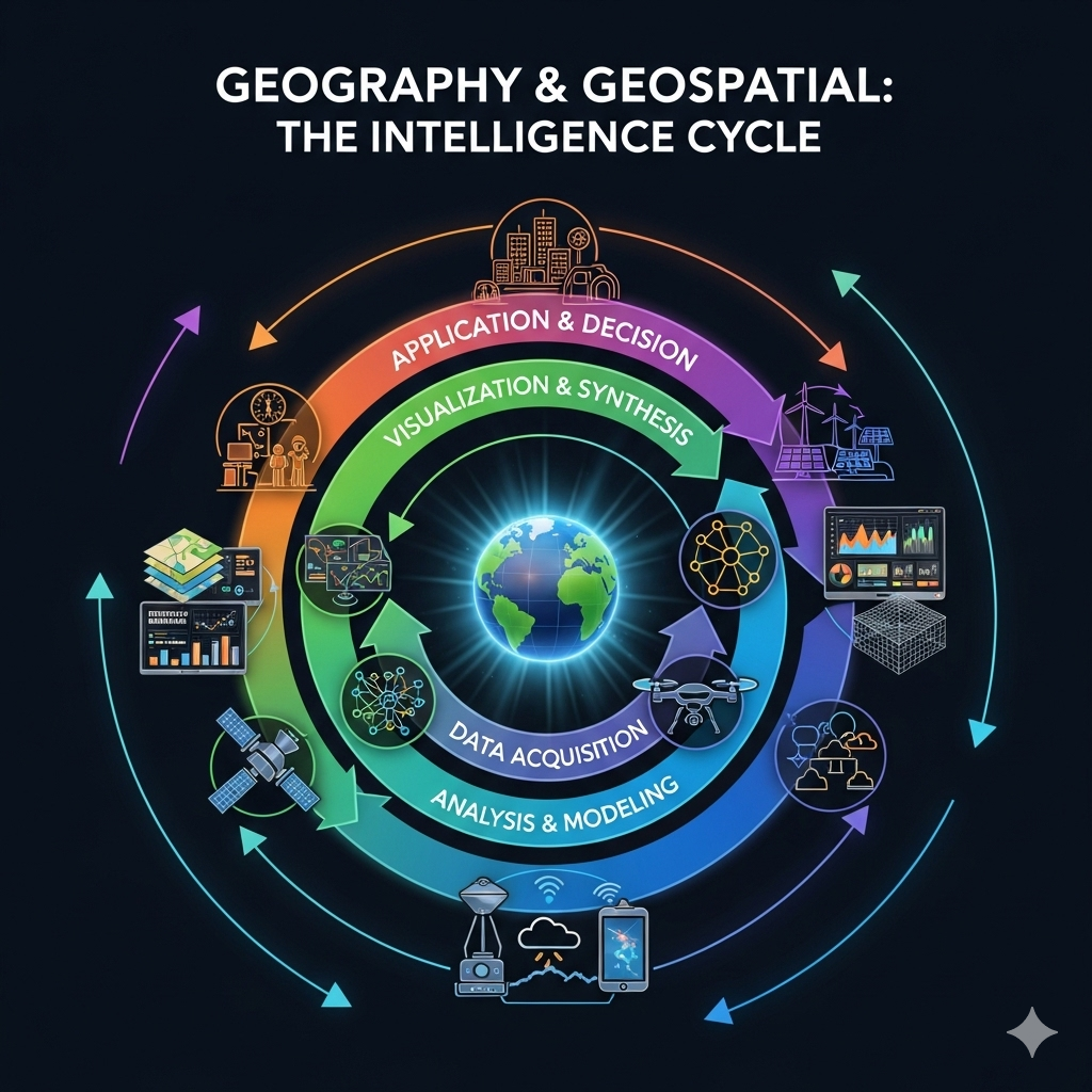
Figure 1 offers a schematic idealization of the Geospatial Intelligence Cycle's iterative logic. While such diagrams provide heuristic clarity, they often mask the politically contingent and methodologically complex realities of each phase. The cycle is less a frictionless loop and more a contested terrain of negotiation, interpretation, and representation, where outputs from one stage recursively structure the possibilities of the next.
Phases of the Intelligence Cycle
Phase 1: Problem Formulation & Epistemological Framing
The cycle's genesis lies not in data, but in the articulation of a question—an act laden with pre-analytical assumptions. This phase determines the very possibility of what can be known, foregrounding certain spatial realities while occluding others. It is an exercise in power, defining the parameters of inquiry and the stakeholders whose interests are prioritized.
- Deconstruction of the Spatial Problem: A critical examination of how a "problem" is socially and institutionally constructed. This involves questioning the ontological assumptions underpinning the inquiry (e.g., what constitutes an "urban slum" or a "degraded ecosystem"?).
- Politics of Objective Setting: Analysis of the power dynamics influencing the formulation of objectives. Whose questions are being asked, and for what purpose? This interrogation is central to understanding the teleological orientation of the entire intelligence endeavor.
- Stakeholder Legitimacy and Positionality: Moving beyond simple identification to an analysis of stakeholder positionality, including marginalized or non-human actors. It requires an engagement with participatory methodologies that challenge top-down definitions of spatial relevance.
- Ethical Scaffolding & Data Sovereignty: Establishing a robust ethical framework that addresses data privacy (e.g., GDPR compliance), representational bias, and emerging issues of data sovereignty, particularly concerning indigenous or vulnerable communities.
An inadequately theorized foundational phase risks producing technically sophisticated yet contextually naive or ethically compromised intelligence, reinforcing existing asymmetries of power and knowledge.
Phase 2: Datafication of Space & the Politics of Representation
This phase concerns the inscription of complex, analogue socio-ecological realities into discrete, machine-readable formats. This "datafication" is not a neutral act of transcription but a process of abstraction and selection, creating a specific, technologically mediated representation of the world.
- Remote Sensing & the Synoptic Gaze: The "view from nowhere" offered by satellite platforms is, in fact, a "view from somewhere," shaped by sensor capabilities, orbital mechanics, and classification algorithms that embody specific theoretical commitments. We must consider not just data, but "capta"—that which is captured, implying an active choice.
- Sensor Networks & Embedded Bias: The placement and calibration of in-situ sensors (e.g., air quality monitors, traffic sensors) often reflect existing patterns of urban and economic development, creating data-rich and data-poor geographies that can exacerbate spatial inequality.
- The Ambivalence of VGI: While Volunteered Geographic Information (VGI) offers democratizing potential, it is also subject to significant demographic and digital divides, potentially overrepresenting the knowledge of privileged groups while further marginalizing others.
- Interoperability & Semantic Heterogeneity: A primary technical and theoretical challenge is the reconciliation of datasets derived from different ontologies and data models. Data fusion is not a simple technical fix but an act of semantic negotiation.
This phase constructs the empirical foundation upon which all subsequent claims are built. A critical awareness of its inherent biases and omissions is therefore non-negotiable for rigorous geospatial analysis.
Phase 3: Algorithmic Governance & the Production of Spatial Meaning
As the intellectual fulcrum of the cycle, this phase employs computational and statistical techniques to operationalize spatial theory. The increasing reliance on GeoAI introduces new levels of analytical power alongside profound challenges related to transparency, bias, and causality.
- The GIS & its Worldview: Geographic Information Systems are not neutral tools but powerful discourse engines that structure analytical possibilities. Their vector/raster data models and geoprocessing functions encode a specific, predominantly quantitative and positivist, way of seeing and analyzing the world.
- Spatial Statistical Inference: Methodologies for pattern detection (e.g., spatial autocorrelation, geographically weighted regression) are employed to move from description to explanation. However, the risk of ecological fallacy and the Modifiable Areal Unit Problem (MAUP) requires sophisticated theoretical guidance.
- GeoAI & Algorithmic Opacity: The deployment of machine learning—such as Convolutional Neural Networks (CNNs) for image segmentation or Graph Neural Networks (GNNs) for network analysis—offers unparalleled predictive capabilities. This is often accompanied by a lack of interpretability (the "black box" problem), creating challenges for accountability and scientific validation.
- Predictive Modeling & Performative Effects: Predictive models (e.g., crime hotspots, flood risk zones) do not merely forecast the future; they can actively shape it through performative effects, influencing policing strategies or insurance premiums in ways that can reinforce existing inequalities.
This phase is a site of intense knowledge production, where abstract data are imbued with meaning. A critical praxis demands constant interrogation of the assumptions embedded within the algorithms and models being deployed.
Phase 4: Cartographic Rhetoric & the Dissemination of Spatial Narratives
The communication of findings is not a value-neutral transfer of information but a rhetorical act. Visualization and synthesis shape how spatial "truths" are perceived, understood, and acted upon, wielding significant persuasive power.
- Critical Cartography: Drawing on the work of scholars like J.B. Harley, this perspective understands maps not as objective mirrors of reality but as "propositions" that advance a particular argument. Choices of projection, symbology, classification, and color are rhetorical devices.
- The Persuasion of Interactivity: Interactive dashboards and web maps create an illusion of user empowerment and objectivity. However, the parameters of this interactivity are pre-defined by the designer, subtly guiding the user's exploration and potential conclusions.
- Narrative Framing & Uncertainty Communication: The construction of a data-driven story requires careful framing. A crucial ethical and scientific component is the explicit communication of uncertainty, model limitations, and data provenance, which is often minimized in the pursuit of a clear, persuasive message.
- Aesthetics and Affect: The aesthetic quality of a visualization can profoundly influence its reception. An elegant, compelling design can engender trust and bypass critical scrutiny, highlighting the need for audiences to develop higher levels of graphicacy and critical visual literacy.
The objective is to move from mere presentation to responsible argumentation, acknowledging the power of representation to shape discourse and influence policy.
Phase 5: Implementation, Governance, & the Reflexive Loop
This final phase actualizes the intelligence, embedding it within socio-technical systems of governance and management. The application of geospatial intelligence is an act of power that reshapes landscapes, influences behavior, and produces new spatial realities.
- Geospatial Governmentality: The use of geospatial intelligence for managing populations, infrastructures, and environments is a key modality of contemporary governance. It enables new forms of surveillance, risk management, and strategic intervention that require democratic oversight.
- Feedback as System Perturbation: The decisions made based on geospatial intelligence do not simply address a static problem; they perturb the system under investigation. For instance, a new transport route alters mobility patterns, generating novel data and requiring a recalibration of the initial analysis.
- Monitoring, Evaluation, & Second-Order Effects: A robust cycle includes mechanisms for monitoring not only the intended outcomes of a decision but also its unintended, second-order effects. This requires a long-term commitment to post-implementation assessment.
- Reflexivity and Institutional Learning: The feedback loop is complete only when the insights from implementation—successes, failures, and unforeseen consequences—are systematically used to critique and refine the epistemological framing (Phase 1) of future inquiries.
This phase underscores the fundamentally political nature of geospatial intelligence. Its application is not the end of the cycle, but the catalyst for its perpetual, and hopefully more reflexive, continuation.
Conclusion: Towards a Critical and Reflexive Geospatial Praxis
The Geospatial Intelligence Cycle, when viewed through a critical lens, is revealed not as a simple technical workflow but as a complex epistemological engine that actively constructs spatial realities. It is a testament to the co-evolution of technology, data, and modes of governance. This exegesis has argued that a post-doctoral, or indeed any intellectually honest, engagement with this cycle must move beyond procedural mastery to a state of critical reflexivity. Such a praxis demands a constant interrogation of the power relations embedded in problem formulation, the biases inherent in datafication, the ideologies encoded in algorithms, and the rhetorical force of cartographic representation.
The ultimate challenge for the field is not simply to generate more accurate or higher-resolution intelligence, but to cultivate a community of practitioners and scholars committed to a more just, equitable, and democratic deployment of geospatial knowledge. Future research must continue to focus on developing frameworks for ethical GeoAI, advancing participatory methodologies that genuinely empower marginalized communities, and fostering a public discourse that is both spatially literate and critically aware. In doing so, we can strive to ensure that the immense power of geospatial intelligence is harnessed not merely for optimization and control, but for collective understanding and sustainable human flourishing.